Initially centred on the Bay of Seine, the activities of the SIG ECUME now cover an area stretching from the Mont-Saint-Michel to the Belgian border, corresponding to the administrative limits of the Eastern Channel / North Sea coastline area.
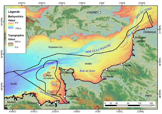
Administrative area of the Eastern Channel North Sea coastline, bathymetric and topographic map (BRGM, march 2024, accessible on the website of the French national public debate commission)
This area is characterised by the coexistence of numerous activities at sea (fishing, dredging and dumping of dredged sediments, marine aggregate extractions, submarine cables, offshore wind farms). These activities have joined forces with scientific laboratories from the Normandy universities of Rouen, Caen and Le Havre within the SIG ECUME, in order to develop a comprehensive and shared approach to studying the cumulative effects of human activities at sea.
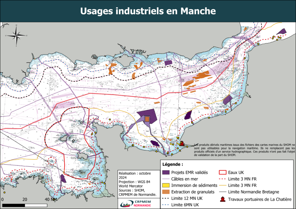
Map of the main industrial activities in Eastern Channel: